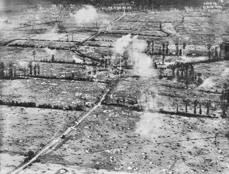
Aerial reconnaissance photo of the battlefield near Bailleul, northern France on 11 August 1918. Heavy artillery bombardments have wrecked buildings and created a very pockmarked landscape. The white clouds are bursts of friendly fire from artillery. Oblique and vertical aerial photography enabled military planners to create detailed trench maps and record battle damage. Oblique shots like this one were taken at considerable risk from ground fire. One of the long-lasting benefits of the development of aerial photography during the war was the ability to create accurate maps of large land areas for the first time.
Air Force Museum of New Zealand
Accession number: MUS95203
Permission of the Air Force Museum of New Zealand must be obtained before any reuse of this image.