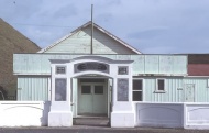
Coastal settlement 79 kilometres south-west of Te Kūiti and 98 kilometres north-east of New Plymouth. Awakino is on the banks of the Awakino River, which rises in the Hērangi Range. Traditional Māori pā sites were clustered along the coast around Awakino. The anchor stone from the ancestral Tainui waka is on the grounds of Maniaroa marae near the settlement. In 1854 the government purchased almost 6,500 hectares of Māori land around Awakino. Because the King Country was closed to Europeans between the 1860s and the 1880s the land was not surveyed until 1883 and was only made available for settlement in 1893. Farming, flax processing and sawmilling were important early industries in the district. Ships plying the North Island’s west coast called in at Awakino. Coastal shipping declined in the area after the bridge across the Mōkau River opened in 1927 and Awakino was no longer used as a port.
awakino
Meaning of place name
Translates as 'bad creek' - awa: river; kino: bad, evil, or of bad appearance - possibly relates to muddy appearance of the river

