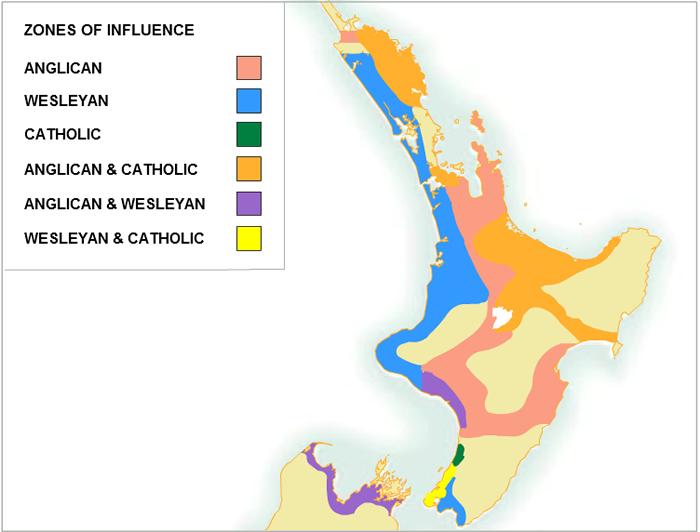
Zones of influence of different missionary groups
Samuel Marsden established the first station, at Rangihoua in 1815. Subsequently, Anglican missions were set up at Kerikeri (1819), Paihia (1823), Waimate (1831), Kaitaia (1834) and elsewhere in the north.
With the Anglicans the dominant force in the Bay of Islands area, Wesleyan (Methodist) and Catholic mission activities were initially centred on the western Hokianga Harbour. Wesleyan missions were established in Mangungu (1828) and Pakanae (1837), while Catholic missionaries founded stations at Papakawau and Totara (both 1838).
Missionary activities expanded in the 1830s although by 1839 there were still no stations south of Ohinemutu (near Rotorua). In the early 1840s several dozen missions were set up, mostly in the North Island; by 1845 there were six stations in the South Island.
Missionary influence peaked in the early 1840s. From this time the missionaries often found themselves at odds with settlers or Maori, and sometimes with both at the same time.