Once the early European explorers had determined the basic outline of the New Zealand islands, the few remaining coastal puzzles were solved by visiting sealers, whalers and those engaged in the early timber and flax trade.
In 1804 the American sealer Owen F. Smith became the first European to discover Foveaux Strait, disproving James Cook’s idea that Stewart Island might be joined to the South Island. Five years later, while trying to sail between what Cook had called Banks Island and the South Island’s east coast, Captain Chase of the Pegasus discovered that the ‘island’ was in fact a peninsula.
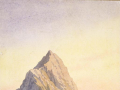
The European ‘discovery’ of the interior would be a much longer process. The surveying and exploration of inland areas was fundamental to European settlement, defining the boundaries of ownership and identifying resources, useable land and access routes. Recent scholarship has also argued that surveying and exploration were equally at the heart of the British colonial vision to claim, tame and name the landscape. Explorers and surveyors viewed the landscape as empty and available, and travelled New Zealand, transplanting familiar names as they went, and ‘discovering’ territory known to Māori for generations.

Much of the artistic work of the early explorers was also done to encourage settlement. It presented a familiar landscape, rich in material resources, and most importantly, available. Parallels drawn between areas in Britain and in New Zealand were reflected in the choice of place names, with Māori names replaced by familiar European ones.
The earliest European explorers of New Zealand’s interior were the early missionaries. On visits to New Zealand in 1814–15 and 1820, for example, Samuel Marsden penetrated well inland; his 1820 journey was a precursor to a long series of missionary journeys by men such as Henry Williams, Octavius Hadfield, and most importantly William Colenso. In 1844 Bishop George Selwyn walked from Wellington to Auckland.
The New Zealand Company played a key role in the settlement of New Zealand. In its reconnaissance for suitable settlement locations, large tracts of land were explored; Frederick Tuckett’s selection of the site for Dunedin followed investigations that ranged from Nelson to Bluff. The lack of viable transport routes between many of the southern settlements and the northern gateway posed major challenges, and by the late 1840s efforts were being made to identify new routes. The 1846 journey by Thomas Brunner and Charles Heaphy was one of the most arduous in the history of New Zealand exploration, the pair journeying from Nelson down the Buller River and the West Coast to Arahura and back over 560 days.
As settlements became more established, the attention of surveyor-explorers increasingly turned to the identification of hinterlands and routes for the transportation of goods. Transport routes in particular were crucial, and only following the European discovery of trans-alpine routes in the 1850s and 1860s could many areas be settled. In the South Island, the search for ungranted land for sheep-runs was one of the primary factors in exploration, leading inadvertently to the discovery of transport routes in both Canterbury and Otago. The 1860s was also a period of unbustled activity for surveyors, who in the process of delineating boundaries and confirming property rights, made discoveries such as Arthur’s Pass and Browning’s Pass.
Gold motivated surveying and exploration in the 1860s. After the initial discovery of gold in Otago in May 1861, men combed the ranges for the precious metal. Prospector-explorers such as Patrick Caples and Alphonse Barrington made extensive journeys into the backcountry. The discovery of gold on the West Coast in the early 1860s saw throngs find passages through the seemingly impassable gorges and impenetrable bush.
The last great wave of European exploration in New Zealand was undertaken in the 1860s in the name of pure science. Men such as Ernst Dieffenbach, Julius von Haast, Ferdinand von Hochstetter and Andreas Reischek covered much of the country, mapping its geology on a scale not previously seen. As Canterbury Provincial Geologist in 1860, for example, von Haast had the opportunity to conduct seemingly comprehensive surveys of the province, sprinkling Geman names over the landscape as he went. Hochstetter and Dieffenbach undertook similar work around Auckland and Nelson, and the central North Island, respectively, while Reischek wandered alone in remote parts of both islands.
Further information:
General
- Te Ara - The Encyclopedia of New Zealand entries on European exploration, Geological exploration and transforming the landscape. These entries also look at other key individuals in the early exploration of the New Zealand's interior.
- A surveyor's basic tools. Discusses typical 19th-century surveying equipment as would have been used in the interior exploration of New Zealand.
Missionary explorers
William Colenso (1811-1899) - printer, missionary, explorer, naturalist, politician
- Dictionary of New Zealand biography entry on Colenso
- Early sketches of New Zealand by Colenso
- Colenso and the beginnings of printing in New Zealand
Samuel Marsden (1765-1838) - chaplain, magistrate, explorer, missionary
- Dictionary of New Zealand biography entry on Marsden
- An encyclopaedia of New Zealand 1966 entry on Marsden
George Augustus Selwyn (1809-1878) - missionary, explorer, bishop
- Dictionary of New Zealand biography entry on Selwyn
- An encyclopaedia of New Zealand 1966 entry on Selwyn
Surveyors
Frederick Tuckett (1807-1876) - principal surveyor of the New Zealand Company; surveyor of the Company's Otago settlement
- Dictionary of New Zealand biography entry on Tuckett
- An encyclopaedia of New Zealand 1966 entry on Tuckett
Frederick Carrington (1808-1901) - principal surveyor of the Plymouth Company. Often called 'the founder of Taranaki'.
- Dictionary of New Zealand biography entry on Carrington.
- An encyclopaedia of New Zealand 1966 entry on Carrington.
- Frederic Alonzo Carrington (Puke Ariki).
Captain Joseph Thomas (1821?-1874) - surveyor of the site of the Canterbury settlement.
- Great site looking at Joseph Thomas and the design of Christchurch
- An encyclopaedia of New Zealand 1966 entry on Thomas.
- Dictionary of New Zealand biography entry on Thomas
William Mein Smith (1799-1869) - surveyor and artist. New Zealand Company Surveyor-General, and surveyor of the Wellington settlement.
- Dictionary of New Zealand biography entry on Smith.
- An encyclopaedia of New Zealand 1966 entry on Smith.
John Rochford (1832-1893) - surveyor and engineer, principally remembered for his surveys of the West Coast of the South Island.
- Dictionary of New Zealand biography entry on Rochford.
- An encyclopaedia of New Zealand 1966 entry on Rochford.
Stephenson Percy Smith (1840-1922) - surveyor, ethnologist, writer. Percy Smith made significant contributions in all of these areas, but as a surveyor, he is remembered principally for his work around New Plymouth and Auckland.
- Dictionary of New Zealand biography entry on Smith.
- An encyclopaedia of New Zealand 1966 entry on Smith.
- Percy Smith and the Scenery Preservation Commission.
Also check out entries on:
- Gerhard Mueller (1834/1835?-1918)
- Charles William Adams (1840-1918)
- John Holland Baker (1841-1930)
- Laurence Cussen (1843-1903)
- William Australia Graham (1841-1916)
- Thomas Cass (1817-1895)
Explorer-surveyors
William Fox (1812?-1893) - explorer, premier, painter, social reformer. As an explorer, Fox is remembered for his 1843 journey into Wairarapa, and his 1846 explorations of the Buller Gorge, Banks Peninsula and Otago.
- Dictionary of New Zealand biography entry on Fox.
- An encyclopaedia of New Zealand 1966 entry on Fox.
Johann Karl Ernst Dieffenbach (1811-1855) - explorer, naturalist, linguist. As a surveyor for the New Zealand Company, Dieffenbach made extensive journeys into the interior of the North Island, exploring Tongariro, Taupo, Waikato, and Whaingaroa.
- Dictionary of New Zealand biography entry on Dieffenbach.
- An encyclopaedia of New Zealand 1966 entry on Dieffenbach.
Johann Franz Julius von Haast (1822-1887) - explorer, surveyor, writer, geologist. Haast is principally remembered for his extensive scientific explorations of the Nelson, and later Canterbury districts in his capacity as Provincial Geologist.
- Dictionary of New Zealand biography entry on von Haast.
- Christchurch City Libraries' site on Haast and the Canterbury Museum.
- Art New Zealand article on Haast's collaboration with John Gully in the exploration and painting of the Canterbury glaciers. Contains some beautiful images.
Edward (1816/1817?-1908) and Arthur (1841-1934) Dobson - surveyors, explorers, engineers.
As Provincial Engineer for Canterbury, Edward Dobson's contribution to exploration principally took place during his development of the Canterbury rail network. As assistant and later Chief Surveyor for Nelson, his son Arthur undertook extensive surveys between Nelson and Westport, including Authur's Pass.
- Dictionary of New Zealand biography entry on the Dobsons.
- An encyclopaedia of New Zealand 1966 entry on the Dobsons.
Charles Heaphy (1820-1881) - Explorer, surveyor, artist, draughtsman
As draughtsman and artist with the New Zealand Company, Heaphy is principally remembered for his reconnaissance survey up the west coast of the North Island and investigations of a site for the establishment of Nelson. As Chief Surveyor to the General Government, at Auckland, his main task was the surveying of land confiscated at the close of the New Zealand Wars.
- Dictionary of New Zealand biography entry on Heaphy.
- Wellington City Libraries' transcript of Heaphy's 'Notes on Port Nicholson' (1839), describing the Wellington region and his experience of local Maori.
- Charles Heaphy on NZHistory
Thomas Brunner (1821?-1874) - Surveyor and explorer.
Brunner is remembered most for his epic 1846-48 exploration of the South Island.
- Dictionary of New Zealand biography entry on Brunner.
- Transcript of Brunner's The Great Journey: Journal of an Expedition to Explore the Interior of the Middle Island of New Zealand , 1846-1848.
John Turnbull Thomson (1821-1884) - surveyor, engineer, explorer, artist, writer. As Chief Surveyor of Otago, Thomson was responsible for much of the survey of the lower South Island. He also prepared a complete scheme for the development of Otago Harbour. He later became Surveyor General for New Zealand and established the Department of Lands and Survey.
- Dictionary of New Zealand biography entry on Thomson.
- An encyclopaedia of New Zealand 1966 entry on Thomson.
James Mackay (1831-1912) - explorer, surveyor. As a Commissioner in the Native Land Purchase Department, Mackay was responsible for the purchase and surveying of many chunks of the South Island. Later government positions allowed him to survey many areas of the North Island.
- Dictionary of New Zealand biography entry on Mackay.
- An encyclopaedia of New Zealand 1966 entry on Mackay.
Ferdinand Ritter von Hochstetter (1829-1884) - geologist, surveyor, writer. Hocstetter's principal contributions include his geological survey of the central districts of Auckland Province, and his later survey of the Nelson Province's 'mineral belt'.
- Dictionary of New Zealand biography entry on von Hochstetter.
- The isthmus of Auckland with its extinct volcanoes, a beautiful example of work undertaken by Hochstetter and his contemporaries.
James Hector (1834-1907) - explorer, geologist, and administrator. As an explorer and surveyor, Hector is principally remembered for his geological survey of Otago and parts of Westland. He was also Director of the Geological Survey Department of New Zealand.
- Dictionary of New Zealand biography entry on Hector.
- Geological Society of New Zealand entry on Hector Day.
- An encyclopaedia of New Zealand 1966 entry on Hector.
Donald Sutherland (1843/1844?-1919) - Soldier, explorer. Lone exploration was his metier. Sutherland is primarily remembered for his exploration of the lower reaches of Westland when few Europeans knew much of the region.
- Dictionary of New Zealand biography entry on Sutherland.
- An encyclopaedia of New Zealand 1966 entry on Sutherland.
Arthur Paul Harper (1865-1955) - mountaineer, explorer, conservationist
- Dictionary of New Zealand biography entry on Harper.
- An encyclopaedia of New Zealand 1966 entry on Harper.
Also check out entries on:
- Charles Edward Douglas (1840-1916)
- Nathanael Chalmers (1830-1910)
- Alphonse J. Barrington (fl. 1863-1864)
Others
Edward Shortland (1812?-1893) - scholar, linguist, administrator, doctor.
- Dictionary of New Zealand biography entry on Shortland.
- Transcript of Shortland's Maori Religion and Mythology, a typical example of the work of early ethnologists, linguists and Māori scholars.