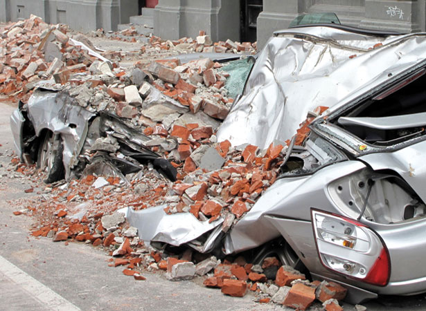
The earthquake which struck at 4.35 a.m. on a Saturday morning was felt by many people in the South Island and southern North Island. There was considerable damage in central Canterbury, especially in Christchurch, but no loss of life.
It was the largest earthquake to affect a major urban area since the 1931 Hawke’s Bay earthquake (see 3 February). The epicentre was 37 km west of Christchurch, near the town of Darfield. As a relatively shallow quake – about 10 km below the surface – it produced the strongest shaking recorded in New Zealand.
Few people sustained serious injuries in the quake, largely because of the time it occurred – most were in bed and the streets were almost empty.
The people of Christchurch would not be so lucky when a 6.3-magnitude earthquake struck a few months later (see 22 February) in the middle of the working day. Central Christchurch was badly damaged, 185 people were killed and several thousand injured. This time the epicentre was near Lyttelton, just 10 km south-east of Christchurch’s city centre.