Field trips are a fantastic way for students and teachers to develop shared experiences outside of the classroom. This field trip – ‘Hidden streams’ – has been run successfully with Year 9 Social Studies students in the past.
Trip details
Health and safety
Schools are responsible for the health and safety of their students. Each school must complete all necessary risk assessments in compliance with their Education Outside the Classroom (EOTC) policies prior to undertaking the field trip.
Estimated time
60 minutes
Starting point
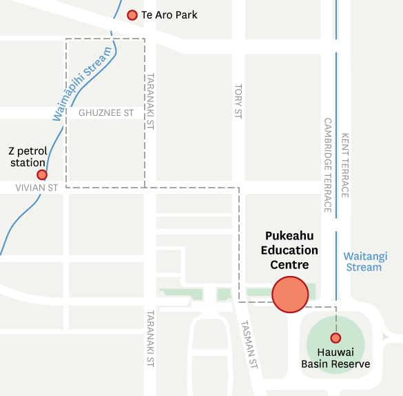
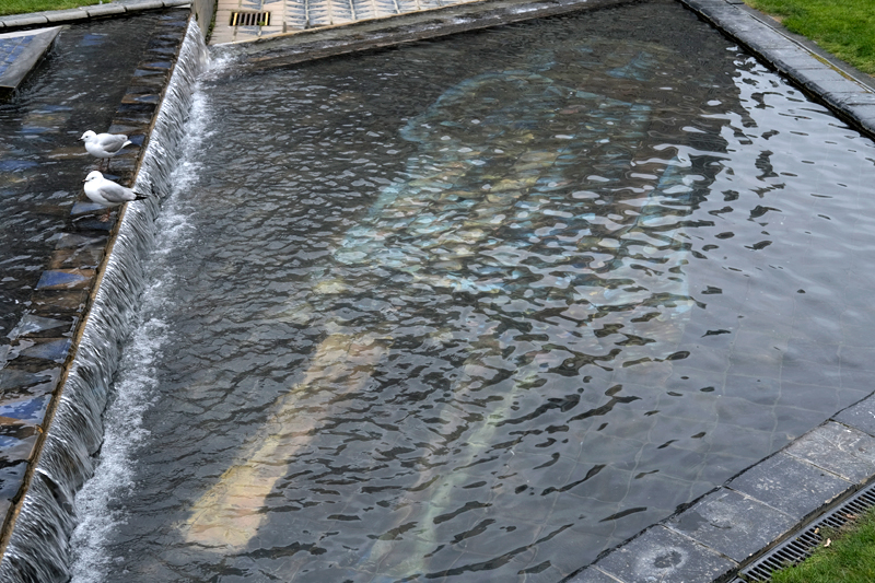
Pukeahu Education Centre
Trip sites
- Waitangi Stream – Hauwai | Basin Reserve
- Waimāpihi Stream – Z petrol station, Vivian Street
- Te Aro Park – Dixon Street
- Pukeahu Educational Centre – Pukeahu National War Memorial Park (optional)
Purpose
This field trip is about the changes that have happened to the landscape in Wellington. It focuses on Wellington city streams – 95.5% are piped underground and made to run in concrete culverts, finding their outlets at the ocean not by nature, but by control. Students will learn about the importance of water and how art can help to tell stories about the past.
Wellington is full of life-giving streams, each with a name and each with a story. Naming places preserves culture and heritage and builds an understanding of ‘where’. Tangata whenua named all the natural features within their physical environment before Europeans arrived. With colonisation, the landscape was systematically renamed – places like Wakefield Park, Adelaide Road, Lambton Quay, Cuba Street, and Oriental Bay. Historic earthquakes in 1848 and 1855 transformed the city further – Oriental Bay was uplifted by 1.5 metres, and reclamation and draining the wetlands were considered priorities by the authorities. As the volume of waste being generated grew, many waterways became polluted. The solution was piping and culverting the streams underground.
Ann Reweti blog about the history of places – Wellington City Libraries
Site information
Waitangi Stream
Location: Hauwai | Basin Reserve
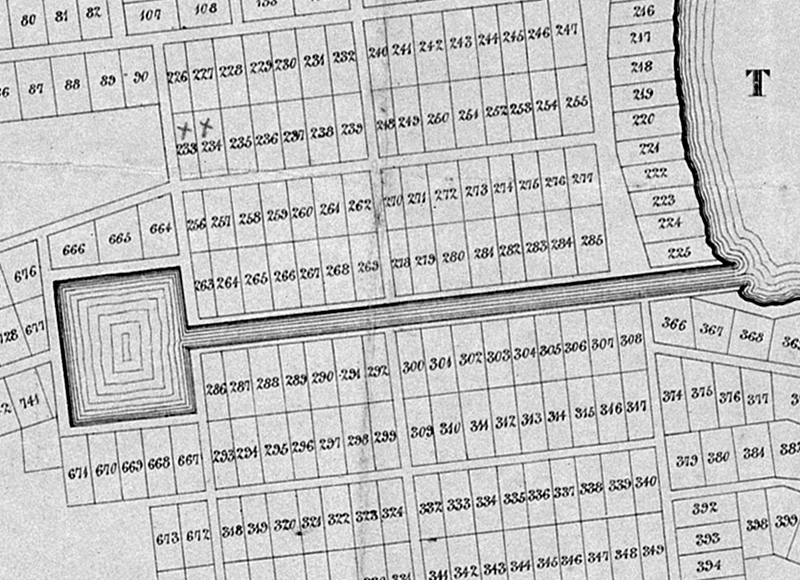
Hauwai/Basin reserve on 1841 Wellington town plan (Alexander Turnbull Library, MapColl-832.4799gbbd/1841/Acc.16266)
Waitangi Stream runs under Cambridge Street/Kent Terrace from Hauwai, the historic wetland now known as the Basin Reserve. These have been significant changes to the land in this area.
Analysis of change and continuity in history – Te Akomanga
Aotearoa New Zealand’s histories curriculum areas:
- Tūrangawaewae me te kaitiakitanga | Place and environment
Waimāpihi Stream
Location: Z petrol station, Vivian Street
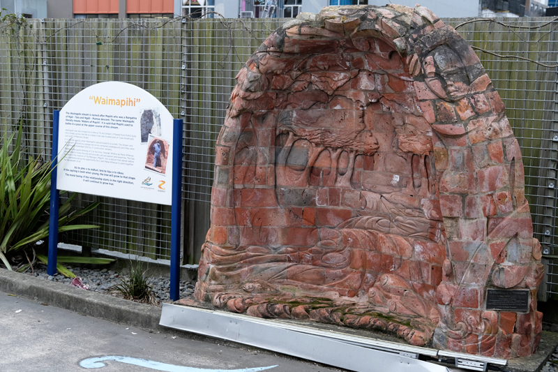
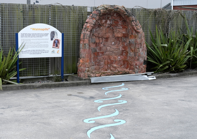
Waimapihi Stream artwork (Manatū Taonga Ministry for Culture & Heritage)
Waimāpihi Stream is named after the waters of Māpihi, a rangatira and tīpuna of Ngāi Tara and Kāti Mamoe. She is said to have bathed in the waters of the stream. During renovations to the Z service station on Vivian Street in 2012, a historic culvert for Waimāpihi Stream was unearthed. An artwork has been made from this clay culvert remembering the history of Waimāpihi. Port Nicholson Block Settlement Trust education coordinator Neavin Broughton (Te Atiawa), who helped examine the Z station site's history, said middens (old food waste dumps) on the site containing shells and old roots dated back 600 years. ‘This stream fed right into the Te Aro Pa and there has been continuous occupation for 600 years,’ he said. ‘It is quite a significant site.’ Waimāpihi was culverted during the 1880s. The stream goes underground at the top of Holloway Road in Aro Valley, runs underneath Aro Valley and enters Wellington Harbour beside the lagoon at Frank Kitts Park.
Pōneke by Ruby Solly is a brilliant example of place-based narrative – Bandcamp
Aotearoa New Zealand’s histories curriculum areas:
- Tūrangawaewae me te kaitiakitanga | Place and environment
- Whakapapa me te whanaungatanga | Culture and identity
Te Aro Park
Location: Dixon Street
Artistic detail from Te Aro Park (Manatū Taonga Ministry for Culture & Heritage)
Te Aro park is a historic pā site. Shona Rapira Davies (Ngāti Wai ki Aotea), supported by Kura Te Waru Rewiri (Ngāpuhi, Ngāti Kahu, Ngāti Rangi and Ngāti Raukawa ki Kauwhata), handcrafted around 30,000 ceramic tiles for Te Aro Park. These tiles have been carefully pieced together in patterns, painted with images, and inscribed with words. The park is designed in the shape of a waka.
Waka and teaching New Zealand history – Te Akomanga
Aotearoa New Zealand’s histories curriculum areas:
- Kōwhiringa ohaoha me te whai oranga | Economic activity
- Whakapapa me te whanaungatanga | Culture and identity
- Tūrangawaewae me te kaitiakitanga | Place and environment