
Click on thumbnail to see detail.
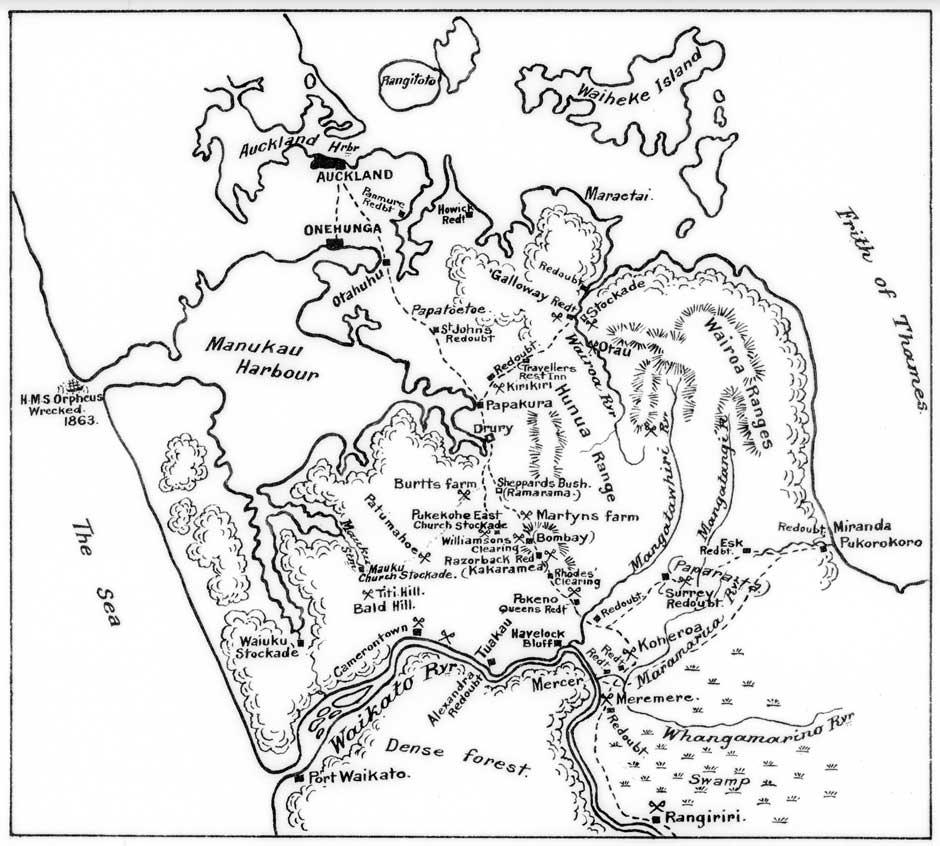
This map was drawn in the early 1920s for James Cowan’s history of The New Zealand Wars and the pioneering period, probably by A.H. Messenger, a draughtsman in the New Zealand Forest Service. It shows the military posts established along the Great South Road. This all-weather road was vital to the British plans to occupy the Waikato basin. The sites of a number of engagements along the road are indicated, as are those of the encounters at Koheroa, Meremere and Rangiriri which followed the initial invasion of Waikato on 12 July 1863.
Alexander Turnbull Library
Reference: 1/2-002209-F
Permission of the Alexander Turnbull Library, National Library of New Zealand, Te Puna Matauranga o Aotearoa, must be obtained before any reuse of this image.