You can also download a hi-res copy as a pdf (2.4 mbs).
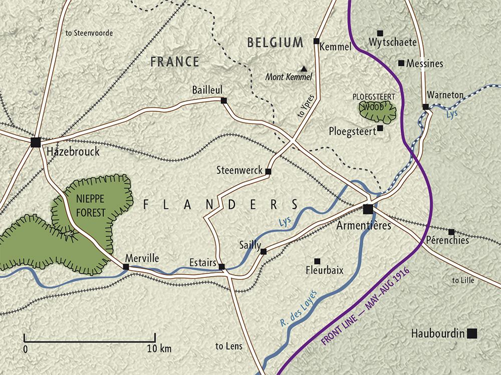
The purple line on the map above shows the front line between May and August 1916 in the Armentières sector, where the New Zealand Division received its introduction to the Western Front.
Following its evacuation from Gallipoli in December 1915, the New Zealand Division was transferred to the northern section of the Western Front, where the British Expeditionary Force (BEF) was concentrated. In April 1916 the Division set up camp around the French town of Hazebrouck on the Flanders Plain (a low-lying region of northern France and western Belgium; the international border is indicated by the dotted line). Here the troops were instructed in the trench warfare techniques that the BEF had developed during the previous 18 months of fighting. This training helped prepare the Division for deployment east of Armentières, where it arrived on 13 May.
Large-scale battles were the exception rather than the rule along the Western Front at this time. In mid-1916 the Western Front around Armentières was seen as a ‘quiet’ or ‘nursery’ sector, with less intense fighting than in areas such as the Ypres Salient to the north. The New Zealand soldier’s experience in Armentières was dominated by the tedium of trench warfare – training, work parties and trudging along the network of communication trenches. Thanks to a complicated system of scheduled rotations, a soldier typically spent only a few days each month in a front-line trench.
Map produced by Geographx with research assistance from Damien Fenton and Caroline Lord.
It originally appeared in Damien Fenton, New Zealand and the First World War (Penguin, Auckland, 2013)