Image
You can also download a hi-res copy as a pdf (10 mbs).
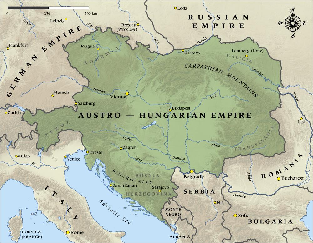
This map shows the boundaries and major cities of the Austro-Hungarian Empire at the time it entered the First World War in August 1914.
Credit
Map produced by Geographx with research assistance from Damien Fenton and Caroline Lord.